Polaroid Photo

Pictures from Wandering Biker

Wandering Biker

“All that is gold does not glitter, not all those who wander are lost…

Choose a Topic:

Payday loans
Payday loans uk
Fri
13
Nov '09

Biloxi, MS to Fort Walton Beach, FL via Panama City Beach, FL – 277 miles

I left Biloxi with Jimmy Buffet blaring on the CD player. “Brown Eyed Girl” came on and I felt sad that “the GF” was so far away back in Durango.

I crossed the bridge to Ocean Springs, MS and then on up to I-10. I stayed on I-10 to Alabama and enjoyed the beautiful view of Mobile Bay on the causeway. After crossing Mobile Bay I got off on US 98, which I thought would be a nice, scenic drive to Pensacola. It was more scenic, but the traffic was heavy and very slow.

When I got to Pensacola I stayed on US 98 and toured the “Redneck Riviera” of beaches along the Florida coast. I had seen some good motel prices in Fort Walton Beach, so when I got to Panama City i doubled back. I’m not scheduled to be in North Carolina until Monday, so I’m going to take a few rest days here at the beach.

Thu
12
Nov '09

Natchitoches, LA to Biloxi, MS – 301 miles

Today was a beautiful southern Fall day. It was a little cool when I Left Natchitoches but quickly warmed up. The drive through southern Louisiana brought up some old memories and I enjoyed listening to some Randy Newman as I crossed the Mississippi on the Huey P. Long bridge.

I took I-12 around the north side of Lake Ponchatrain and when I got into Mississippi I dropped down to the Gulf coast on US 90. I hadn’t been through here since Katrina and was interested to see how the reconstruction was going.

After a few miles the Gulf of Mexico and the beaches came into view.

I got a room in Biloxi at the Biloxi Grand Casino with a pretty nice view.

After settling into my my room I found a little seafood restaurant. had some fried crawfish tails for dinner and then went back to the casino to lose a little money.

Wed
11
Nov '09

Amarillo, TX to Natchitoches, LA – 617 miles

Today was a waltz across Texas.

I left the hotel around sunrise. After picking up some Mcbreakfast I ran into some fog about 10 miles out of town. The fog was heavy at times and lasted most of the way to Wichita Falls. It wasn’t all that unpleasant and kept the morning sun out of my eyes.

Topping a hill near Electra, TX I spotted a state trooper coming towards me and slowed down 5 mph to the speed limit. Too late. He crossed the median and pulled over on the side of the road and waited for me to go by and then pulled me over. After producing my driver’s license and insurance card and answering some annoyingly direct questions about where I was going I received a warning for going 5 mph over the speed limit. Fair enough.

I managed to hit Dallas at mid-afternoon and didn’t run into any real traffic problems. Timing is everything. Some of the roads were down to one lane for construction and I am sure it would have been a parking lot during rush hour.

Thought about stopping in Shreveport, LA but it was a little early so I continued on to Natchitoches, LA. Had dinner at Popeye’s Chicken and found a room for the night.

Tue
10
Nov '09

Durango, CO to Amarillo, TX – 492 miles

After a break of a little over a month I am back on the road. I’m leaving Durango and heading to North Carolina eventually. My dear friend Carrie has offered me one of her spare bedrooms while I try and find work.

I had to make a few last minute stops on the way out of Durango so I didn’t actually leave town until 8:45. The weather has been beautiful the last week and I am really sad to be leaving while it is still so nice.

The GPS wants to take me east on US 160 over Wolf Creek pass, but I have been that way so many times in the last few months that I decide to drop south and take US 64 over the mountains through Taos, NM. US 64 between Tierra Amarilla and Tres Piedras, NM is one of my favorite motorcycle roads.

West of Taos there is a large area of alternative houses, ranging from yurts to Earthships. I stopped and took a few pictures of one of the showcase Earthship structures.

A little farther east towards Taos is the Rio Grande gorge.

From Taos I headed south through Mora, Las Vegas and Tucumcari, NM. The road between Las Vegas and Tucumcari is very desolate but runs through an area of mesas.

At Tucumcari I got on I-40 and stopped for the night in Amarillo, TX.

Wed
7
Oct '09

Gallup, NM to Durango, CO via Hubbell Trading Post National Historic Site, AZ – 278 miles

Got up early again and checked the weather. It was 42 degrees and the radar showed showers to the west heading northeast. Decided to wait until 9:00AM to leave so the temps could come up a little, but got restless and left earlier. In an effort to keep warm I wore jeans underneath my riding pants as well as my (non-working) electric vest and my rain jacket.

I ran into the first few drops of rain just north of Gallup. After turning west on Rt. 264 I ran into a fairly heavy downpour and then broke out into a sunny area between storms and had a beautiful rainbow to ride towards for a while. I ran into another heavy downpour that lasted long enough that I could feel the rain start to soak through my riding pants and then busted out of the rain showers on the west side.

I’m glad it was dry at the Hubbell Trading Post because the entrance driveway is dirt.

The Hubbell Trading Post National Historic Site is the oldest continuously operating trading post on the Navajo nation. In addition to the trading post itself is a National Park Service visitor center. I poked around the trading post a bit and then walked over to the visitor center and got my National Parks Tour stamp.

Here is a picture of the trading post..

and here is a picture of the visitor center.

Woohoo! This stamp is my 25th state and completes the requirement of 50 sites in 25 states I need to get my National Parks Tour certificate from the Iron Butt Association.

Heading west from the trading post and then north on US 191 I see a storm approaching from the west. As I travel north it is getting closer and closer and I’m concerned it is going to catch me before I turn east on US 160. Even though I am racing the storm I stopped and took a few pictures of it.

I managed to beat the storm to the intersection with US 160 and headed east. Got back to Durango in the early afternoon, put the bike in the storage unit and retrieved the car. It felt strange to be driving in the car after three weeks on the motorcycle. I’ll be staying in Durango for a few days to catch up on people and things.

National Parks Tour progress so far – 54 sites, 25 states.

Tue
6
Oct '09

Elk City, OK to Gallup, NM via Washita Battleground National Historic Site, OK and Lake Meredith National Recreation Area, TX and El Malpais National Monument, NM – 662 miles

Woke up early this morning and got out the door right at 8:00AM. There is a very strong north wind to fight up to my first stop.

Washita Battleground National Historic Site is at the site of an attack on the Southern Cheyenne village of Peace Chief Black Kettle. There are guided and unguided walking tours as well as an overlook site that was closed the day I was there.

I headed out west across the Oklahoma and Texas plains. The north wind was very cold and fierce and I ended up following cars as much as I could so there would be someone close by if I got blown off the road or worse.

Lake Meredith National Recreation Area surrounds a man-made lake on the Texas panhandle. It provides drinking water to 11cities as well as recreational activities. The lady at the headquarters was very nice, but there was really nothing to do at the headquarters so I got my National Parks Tour stamp and moved on.

Heading south towards Amarillo with a tailwind the bike felt like I had twice the normal power and I had a good time passing cars like they were standing still. When I got to Amarillo I got on I-40 for the long slog west. Thankfully the wind subsided the further west I rode and wasn’t a problem the rest of the day.

With the time zone change it looked like I might be able to make my next stop before it closed for the day. Making this calculation tough was the many construction areas along the route along with my uncertainty of the closing time. I decided to forgo my normal afternoon snack stop and made a quick fuel stop. I managed to make it to El Malpais National Monument just 10 minutes before it closed at 4:30PM.

El Malpais means “the badlands” and this lava covered area fits the bill. There are lava flows, cinder cones, pressure ridges and lava tubes to explore.

Since I got this stop out of the way so early I continued on to spend the night in Gallup, NM. Today was the longest day of my entire trip.

National Parks Tour progress so far – 53 sites, 24 states.

Mon
5
Oct '09

Hot Springs, AR to Elk City, OK via Fort Smith National Historic Site, AR – 428 miles

When I got up this morning it was very overcast, but the rain had stopped and the parking lot was dry. It was a little chilly so I “installed” my jacket liner. I say “installed” because this one is a pain in the ass to put in compared to my previous one. I actually took it up to my room so I could lay the jacked flat and put the liner in. It’s like a 10 minute job. I hate doing it by the side of the road.

Went way past the Hot Springs National Park visitor center and had to ask for directions, but still made it to the front door before they opened. The visitor center is in the restored Fordyce Bathhouse. There are 26 miles of walking trails in the park as well as the Hot Springs historic district.

The roads out of Hot Springs towards Fort Smith are curvy and there was a good bit of truck and motor home traffic. It got even chillier than it was in Hot Springs and I ran through some patches of fog. Was glad I had the jacked liner in. It warmed up some as I got out of the mountains and close to Fort Smith.

Fort Smith National Historic Site is located pretty much right in modern downtown Fort Smith. Thankfully it was not too hard to find. There are actually two different locations for the Fort and both are accessible from the parking lot as well as a Trail Of Tears overlook. The fort was used as a federal court as well.

Between Fort Smith and Oklahoma City I ran through a couple of short rain storms that didn’t last very long. The sun came out for a little while so I stopped and put on my sunglasses.  Of course this jinxed the weather and things were looking pretty gray and nasty about 20 miles east of Oklahoma City. I stopped and took off the sunglasses, put on the electric vest and my rain jacket. From there on I was riding in a light mist and fog and it got cold again. I was glad when I got to Elk City and found a motel with an attached restaurant. I never really got very wet, just cold and damp.

National Parks Tour progress so far – 50 sites, 21 states.

Sun
4
Oct '09

Hot Springs, AR – Rest Day

Woke up this morning and it was raining. After checking the weather channel and seeing that I would be riding all day in rain I decided to take a day off from riding. Scarfed up a bunch of food from the “continental breakfast” at the motel so I didn’t have to go out for lunch and settled in for the day. Updated the radio station, watched a NASCAR race, paid a bill, called some friends and played a computer game. It was misting at dinner time so I went a few blocks and got a bite to eat. Tomorrow looks better.

Sat
3
Oct '09

Clinton, MS to Hot Springs, AR via Vicksburg National Military Park, MS and Magnolia Plantation, LA – 486 miles

Stayed up too late last night and just couldn’t get rolling this morning. It’s another beautiful day for a motorcycle ride.

My first stop is just a short hop down the interstate to Vicksburg National Military Park. The siege and eventual surrender of Vicksburg to the Union army gave the North control of the Mississippi River. There are over 1,340 monuments and a 16 mile auto tour route in the park.

After getting my National Park Tour stamp at Vicksburg I headed out across the Louisiana delta, where cotton is still an important crop.

My next stop was at Magnolia Plantation, part of the Cane River National Heritage Area. There didn’t seem to be anyone there, so I wandered around and eventually found the stamp, took a few pictures and left.

From there is was a long slog through northern Louisiana and southern Arkansas to get to Hot Springs, where I will get a stamp tomorrow.

National Parks Tour progress so far – 48 sites, 20 states.

Fri
2
Oct '09

Muscle Shoals, AL to Clinton, MS via the Natchez Trace Parkway and Brice’s Crossroads National Battlefield and Tupelo National Battlefield – 287 miles

The plan for today is to travel down the Natchez Trace Parkway collecting as many National Parks Tour stamps as I can.

It has rained overnight as a cold front went through but it is only sprinkling lightly when I get up. The weather station shows that the skies are clearing rapidly from the west. It turns out to be an absolutely beautiful day.

I’m anxious to get going and I keep having to remind myself that this is going to be a slow, relaxing day. Things move slower in Mississippi and the speed limit on the Natchez Trace is mostly 50 mph. I get out the door of the motel late after a frantic search for my camera and when I get to the motel office to check out there is a “Be Right Back” sign in the window. Relax…. relax…..

The Natchez Trace Parkway follows ancient hunting and foot paths that connected Natchez, Mississippi and Nashville, TN. Commercial traffic is not allowed on the Parkway and there are many scenic and informative pull offs along its route. Most of the route is through rural areas and there are almost no services on the parkway itself.

I leave town on state and county roads to get to the Parkway just north of the Tennessee River crossing. The river is very wide at this point and actually looks more like a lake than a river.

My first stop is at the Colbert Ferry ranger station and I pull up just as they are opening and raising the flag at 9:00. I laugh at my earlier impatience realizing that it would have done no good to get here any sooner. I get my stamp and a great map of the Parkway from the ranger.

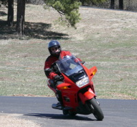
I stopped just after entering Mississippi and took a few pictures.

This is a good example of the many informative turnouts on the Parkway.

And the next two photos are pretty much the view I will have all day.

My next stop requires me to get off the Parkway after about 50 miles and go through the town of Baldwyn, MS to get to Brice’s Crossroads National Battlefield.

The battle at Brice’s Crossroads wa a fairly minor one in the Civil war, so I get my stamp and head towards Tupelo, MS, where I get a stamp at the Parkway Headquarters and another for the Tupelo National Battlefield, another fairly minor Civil War battle that continued after the Brice’s Crossroads battle.

Continuing down the Parkway I stop at Jeff Busby, which looked like it used to be a gas station and probably used to have a stamp. It doesn’t any more and I think this is the first time on my trip that a stamp hasn’t been available where my information told me there was one.

My next stop is a re-creation of a stop on the old Trace at French Camp, MS. I got a stamp from the nice lady in the gift shop and took a couple of pictures.

Continuing south I get a stamp at the Kosciusco Visitor Center and after a scenic drive along the banks of the Ross Barnett Reservoir I get off the Parkway in Ridgeland, MS to get a stamp at the Mississippi Crafts Center.

Getting back on the Parkway I follow a fairly new (to me and Microsoft Streets and Trips) section of the Parkway around Jackson, MS to the visitor center in Clinton, MS. When I ask about getting a stamp at the Clinton Visitor Center the nice lady has no idea what I am talking about. After getting out my National Parks Passport book and showing it to her she assures me she would know if something like that existed because she has read the volunteer manual cover to cover but definitely will recommend that they get one. I’m about to leave when I see a stamp and ink pad right next to me on top of the donation box. Of course it is the National Parks Tour stamp that I need. We have a good laugh and she apologizes profusely.

It is too late in the afternoon for me to get to my next stop in Vicksburg, MS so I head towards the interstate and find a motel for the evening.

Woohoo! Eight stamps for the day and a beautiful day for a motorcycle ride.

National Parks Tour progress so far – 46 sites, 19 states.